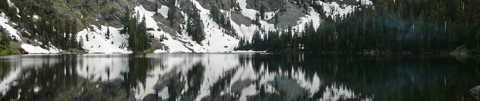
Siskiyou Wilderness; Devil’s Punchbowl and Raspberry Lake; Sep 1-4, 2020
Hikers: Tony D, Kim M, et al.
Trip Report (.pdf)
Oregon Coast Day Hikes, Pt. Orford; Sep 7-10, 2020
Leader: Mary “Fireweed” K.
Hikers: Tysen and Diane M., Bonnie J., Jane K., Barb “Bashinka” S., Bernadette L., Mike and Gladys S., Cory R., Greg C., Ana R., Len W., Terri B., Rosalie R., Mary E.
Mon, Sep 7: travel to Pt. Orford and meet at 5 PM at the restaurant Griff’s on the Dock. This was a small restaurant, but some people sat outside, braving the breeze. Excellent fish and chips. Some people didn’t meet us at dinner but went straight to their campsites at Humbug Mountain State Park and various motels in the area.
Tue, Sep 8: Hike from Flora’s Lake to Blacklock Point 5.6 miles. We all met at the Cape Blanco Airport north of Pt. Orford at 9 AM to arrange the 20 minute shuttle to the start of the hike at Flora’s Lake. We started hiking from Flora’s Lake between 9 and 10 AM. The sky was gray from smoke. We hiked on the beach for about 15 minutes before veering off onto the Oregon Coast Trail though the trees, where we stayed for the rest of the hike. Around 11:30, hike sweep Mary E. got a NIXLE alert on her phone for the Almeda Fire. The message said it started near the Dog Park and Quiet Village. There was a very strong SE wind which would make the fire spread away from our houses, so we decided not to abort our trip. We shared info with each other as we hiked along.
There were several good views down the coast. At Blacklock Point you could see the Cape Blanco lighthouse. We had lunch at Blacklock Point and returned to cars parked at the Cape Blanco Airport. It was very hot for the coast — in the 90’s. The hike ended about 3 PM.
Wed, Sep 9. We met at 9 AM at the Humbug Mountain trailhead just north of the Humbug Mountain State Park campground. There was so much smoke, the top of Humbug Mountain was obscured. I decided to cancel the hike because we would be breathing heavily climbing the mountain, which would be hazardous and there would be no view fom the top. Instead, we hiked along the beach south of Pt. Orford from Battle Rock for a couple hours. We had lunch back at Battle Rock Wayside. In the afternoon, hikers visited art galleries and some hiked around the Pt. Orford Head — old site of a Coast Guard station that had a shipwreck rescue ship. At 6:30 PM we met at Redfish Restaurant in Pt. Orford.
Thu, Sep 10. Highway 199 was closed south of Cave Junction due to fires. Returning to Ashland through Bandon and Highway 42 was open.
Kudos: I want to thank everyone for being flexible with hike plans. Also, the multi-car shuttle went off efficiently and quickly. Mary E.: for alerting us to the fire and keeping us informed about return road conditions. And to everyone — we really got a lot of info about the fire situation from our phones and shared it. There was no cell service at Humbug Mountain State Park campground.
Lessons Learned: For leader: Don’t put phone on airplane mode to be able to talk to sweep and get emergency updates, use the flagging method to indicate trail turns (leader ties flagging on trail at junctions, sweep removes flagging), complete waivers either at meetings or online and email them to BIG president at the beginning of the season.
Slideshow — on Dropbox; click on a photo; slideshow controls at bottom.
Redwood Creek to Tall Trees; Aug 18-20, 2020
Hikers: Barb S., Tony D., Lisa & Max A., Sarah L.
Aug 18. The group left Ashland, with permits for camping and parking procured, at 9:00 on Tues morning. One car had Lisa’s family in it, Tony and Barbara used a second vehicle (wearing masks).
After an uneventful 3 hr. drive to the turnoff from Highway 101 to Little Baldy Road, we located the parking lot for Redwood Creek TH, and got off after a snack and checking of maps at the trailhead.
The trail was actually a tree–lined roadbed from the logging road use in the 40s and 50s. The park was designated in 1968 when the road became a level trail, graced with blackberries and redwood trees.
Our group of teenager Sarah, her older brother and mother, and two other backpackers handily made it to a dispersed campsite along the creek, at mile 3, just past the horse camp Elam, by 3:30 in great sunny weather. Our packet of information with our free permits issued by the California National and State Parks, gave us directions as to where to camp, how to do the wilderness well with good camping habits, and ample maps. We checked out the horse camp Elam, and decided that the sandbar dispersed campsite was superior to any non-creek side area.
We found spaces for our tents on sand, just across from a kingfisher’s home. The trees on both sides of the creek loomed high and provided a welcome for the next day’s hike to the Tall Trees Loop Trail. After a group supper and game of hearts, we secured our food in bear bags and slept well without any disturbances from weather or wildlife.
Aug 19. The morning heralded with a light fog which burned off by 9:00, when we left our camp for the 4.5 miles hike to the Tall Trees Loop. Along the way, we were looking up at tall trees, thinking that no other trail could offer much more beauty. We walked generally flat, few ups and downs for stream crossing, few stepping off trail for other hikers, but in shade most of the time from the numerous trees. At the end of the trail, just before we crossed the creek for the last time with a trail bridge, we noticed a large expanse of alders, which grew up after the clear cutting of the redwood trees, in the 60s. It was a very noticeable departure from the coniferous landscape.
At the end of the trail we came to the loop trail which looped about 1.5 miles through huge, old redwood trees.There had been an informational brochure to match the numbers of stops to describe the various aspects of the trees, but it was unavailable at this time, leaving us with the ability to make up what may have been written about the marvelous trees. A most remarkable sight was the California laurel nurse tree, with numerous new trees, more than 15, springing up from the sideways mother tree. We saw that display with the redwood trees too.
After our self-guided tour, we headed back to camp, 4.5 miles, and made it to our nearby swimming area by 4:00. The sun was high without clouds and we enjoyed a warm afternoon and evening.
Aug 20. In the morning, we rose to full sunshine and packed up camp, to be on the trail back to the parking lot by 9:30. Our walk back through the blackberry brambles and redwood trees was delightful. Our group separated, one car to the beach, another to the Thomas H. Kuchel Information Center to find answers to numerous questions we had about our trail experience. Thanks to the structure of the park and the kind weather keeper, we had a wonderful trip
The most useful telephone number for procuring the permits and directions was 707 464 6101, although that information center may change due to changes of the Covid 19 situation. Their website for Redwood Creek Tall Trees Loop Trail was very helpful.

